Meghalaya and the start of my Sabbatical
I always wanted to travel to the North eastern part of India. Having travelled almost across the whole country, the North east remained a corner which I could not get the opportunity to touch till date. But this year, coincidentally I was jobless and a couple of friends were headed to one of the seven sisters – the abode of clouds, Meghalaya.
Like a scene is taken from travel movies, my college friends, three of us, headed off to Meghalaya this month. Suddenly the plan was chalked out, tickets booked, I headed off to Kolkata first, quitting my job. The plan was to reach Guwahati first and head to Shillong via road.
Here’s a quick snapshot
Day 1: Land in Guwahati at around noon. Vehicle waiting at the airport. Cab to Cherrapunjee (172km?—?5/6 hrs). Stay night here.
Day 2: Cherranpunjee sightseeing and then off to Dawki?—? Bangladesh border. Umngot River and then off to Shnongpdeng for night stay.
Day 3: off to Mawlyngong and the living root bridge. Stay the night here.
Day 4: off to Guwahati, via Shillong. Back home.
The three of us get together at the Kolkata airport to mark the beginning of the trip. With the regular catching up and getting the updates on everyone’s “haal-chaal”, I snuck in my breakfast, a chicken puff and a black coffee (aas usual).
Kolkata – Guwahati – Cherrapunjee
The flight from Kolkata crosses over the many rivers of Bangladesh. As the plane flies towards the destination, I got the chance to see Bangladesh for the first time. Water and greenery everywhere is how Bangladesh appealed to me. From the top, it all looked so pure, so close to nature. I made an entry to my wanderlust of places to travel to, and promised would return to Bangladesh one day soon over land instead of the sky. So as we were nearing our destination Guwahati, the small mountains and the greenery of Meghalaya started to appear across the horizon, welcoming us all for a very pleasant stay I hoped.
So a fun fact: You can drive from Kolkata to Shillong through Bangladesh, via the Dawki International border checkpoint. Our driver there was telling us by 2019-20, the roads will be open for tourist use and we could drive via Dhaka to Shillong in about 8 hrs from Kolkata. Bangladesh has on arrival visa too.

To travel across Meghalaya we hired a vehicle on the suggestion from my uncle. Saifuddin, our driver, tour guide for the next 4 days was already waiting for us at the Guwahati airport. As soon as we landed at Guwahati, we left the airport, sat in the car and headed off towards Shillong and ahead. With a mix of Bollywood and English music in the background and the terrain changing from the plains of the Brahmaputra River at Guwahati to the hills of Meghalaya, we start the road trip towards Cherrapunjee. The highway to Shillong (NH-40) was recently developed to a 4 lane highway, a beauty in the list of roads of India. The drive through the curvy hills, greenery surrounding the roads offer a splendid experience for any traveller. After a long time, I was not driving at all. Over the last couple of years, I had become so used to driving myself, that initially, it felt quite weird to not touch the car at all, this time. I was the co-driver, the person next to the driver, all the time during this whole trip. For a change, it felt absolutely relaxing this time with no effort driving around, or planning the roads, or the stops. Sitting back in the front seat, I enjoyed the scenery the whole trip. Struck up good conversations with Saifuddin, an ex BSF soldier, who has some great experiences to share.
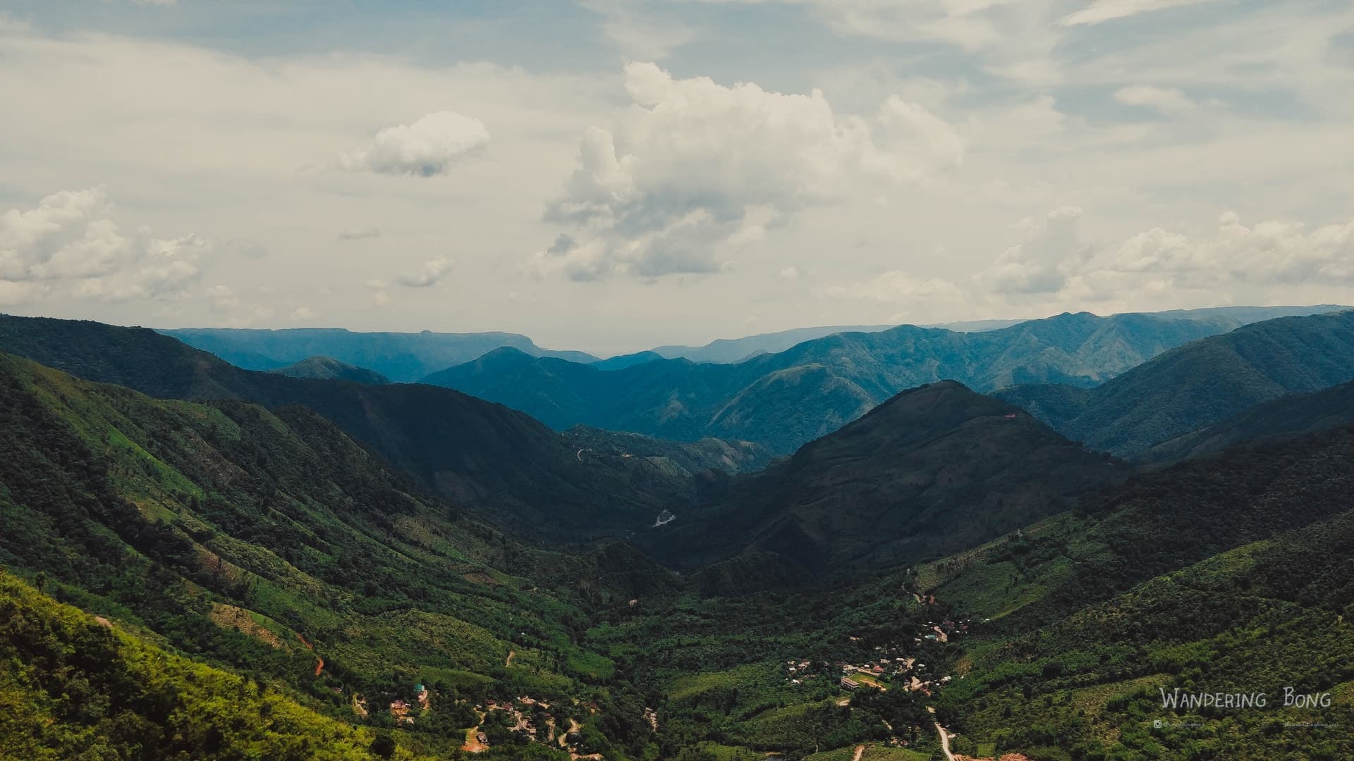
We crossed Shillong and headed towards Sohra or Cherrapunjee for the first night of our trip. The four-lane highway from Guwahati till Shillong, recently upgraded from a single lane, superbly maintained throughout the stretch. The roads of Meghalaya, in general are very well maintained and clean. We got only about 30 mins – 1 hr worth of bad roads in the entire journey. For a hilly state, it’s a very good track record. The journey from Guwahati to Shillong, takes you from the plains of the river Brahmaputra to the hills, rivers, waterfalls and the lush green of Meghalaya. As soon as you enter the state of Meghalaya, the hilly roads start and you drive around the curves in the hills. We crossed Shillong the first day and headed straight to Sohra. A while after you cross Shillong and towards Sohra, you are created to the Table top mountains of the Mawkdok Dympep Valley. Our first spot of attraction in this trip.

From here on these table tops accompanied us to a where we were driving on top of one such hilltop. Along the route, it seems as though the mountains are also travelling with you, guiding you through the unknown roads (though nothing is majorly unknown in this age of technology). Once you near the top of one such, you get to see the magic of driving along valleys on each side of the road. With waterfalls dotting the scenery in the distance.
Cherranpunjee (Sohra) – on the top
Cherranpunjee or Sohra is on one such mountaintop. We reach Sohra just in time with the sun setting down over the hills. As we had not booked the hotel earlier, it became a bit chaotic in the end. I would suggest booking hotels before the start of your journey itself. Airbnb and other online portals have some good options available too. A detailed blog for Cherranpunjee coming up soon.
The place is pleasant in the evening, with a cool and calm breeze flowing. Known as the place for receiving the most rainfall, our good luck I would say, we did not see a single drop of rain at Cherranpunjee. After finally getting a homestay to stay and the booze bought we retired for the night. We spend the evening and early night under the night sky, drinking and the usual “adda” session continuing till midnight.
[Coming Soon] Read more about Cherranpunjee and places of interest over here.
After a good night’s sleep with a great weather, I woke up to a clear and sunny day at Cherrapunjee, which according to locals in itself a rare sight there as it mostly covered in clouds.

After a few cups of tea and some roaming around the homestay to get the body moving, we head out.
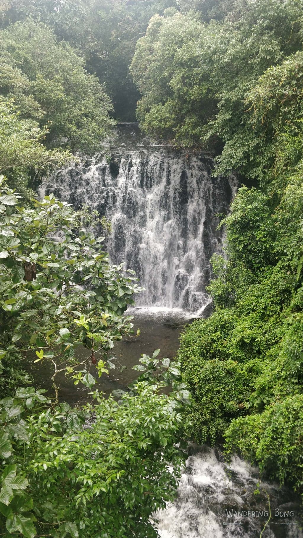
First stop, Nohsngithiang Falls (the seven sisters waterfall).
Nohsngithiang Falls, they form a seven-segmented waterfall, which plunges over the top of limestone cliffs of the Khasi Hills. The falls only flow during the rainy season though. The Seven Sisters Falls have the reputation of being the fourth highest waterfalls in India. One can also see the plains of Bangladesh from here. Ideally try to visit this point during dusk.

Next stop was, Mawsmai cave, just about 5kms from the falls. Mawsmai caves in the local language mean Oathstone caves.The caves have an entry of 10 rs per head and a camera charge. These caves are well maintained and save for the tourists. Only 150m of it has been open to the public. The interesting thing here is that you enter from the mouth of a giant monster and exit from its rear. The cave is 820 feet long which is lit up with halogen lamps, which are awe-inspiring, spine-tingling and mysterious.

The caves are made of limestone. There’s a kind of calm, silence inside the caves, kind of an eerie feel to it at the first look. The entrance is well lit, but as one enters further inside, space starts to cramp up, narrowing down to small corridors at certain points where only one person can pass through at a time. There are places in the cave, where visitors need to bend and squeeze themselves out. This place is unusually beautiful and adventurous. There’s some water inside too, about ankle depth, so better leave your footwear out, so wear slippers.


The cave is well lit with lights, but eeriness still tags along the whole cave. With a pungent smell hanging over the whole place. While at some places, the openings are big enough for a person to just crouch, in other places the roofs are as high as 20-30 feet! We could see each and every detail of the rock formation. This magnificent natural wonder is the result of years of underground water movement. These limestone caves have the distinction of being the only caves in Meghalaya that enable tourists to enjoy the natural formations in awe. The continuous dripping of the water from the cave roof continues to work like a patient artist.
After all this sightseeing and so much activity, it was time for some breakfast. And momos to rescue. We had lots of momo and omelettes and headed out for the Eco Park. This is basically a park on top the seven sisters waterfall. I mean like literally on top of the waterfall. Source of one or more of the seven sisters waterfall is in this park. A good place to spend some time with some good view points, and nice walking lane for a short walk.

Edge of the waterfall from the Eco park


With major attractions of Cherrapunjee covered, we headed off to Dawki. Dawki is about 90 kms from Cherrapunjee, and we had to go back half the road towards Shillong, from where there is a bifurcation that goes towards Dawki. Enroute we stopped at a view point of a valley, Mawkhong View Point.
We were greeted to such a pleasant view, that this was the Meghalaya I fell in love with. For this view itself I can travel to Meghalaya again.
Dawki – the enchanted land
As we head towards Dawki, we cross some stunning landscapes, each worthy of a painting of the scenery. Dawki is at the international border with Bangladesh, and as we approach the plains, the weather starts to get warm, the forest more green and the air a bit humid. At the first impression, Dawki seems to be a crowded town, dirty, full with tourists, a hyperactive market, very unlike the Meghalaya we had experienced till now. But as soon as we got out of the car and headed towards the river, it was magical.
Okay, now hold on, imagine this, you get on a boat that takes to along a stream so clean that you can see what’s under the boat, surrounded by dense green tropical forests, encompassed by the sounds of birds and the river flowing to an island upriver. Boating in between the mountains and heading to up river to a spot in the river bank. – Mesmerising?

Unmgot River


Welcome to the Umngot River in Dawki. The Umngot River is considered as one of the cleanest rivers in India. Clean and stunning. A natural divide between Jhantia and Khasi hills, this river flows into Bangladesh through Dawki. They say that on a good day, the water of the river is so clear that the boats seem floating on it. There’s a creaky old suspension bridge built by the British over the Umngot river in Dawki. Only one vehicle is allowed to cross the bridge at a time & there’s an army patrol at the bridge. Ironically, our driver had served first duty as a BSF soldier at this bridge itself, and shared a few stories with us.

We were heading to an island upriver in a narrow boat, and the boatman was sitting at the top at one of the ends of the boat. A very peculiar design, one that does not give a lot of confidence initially to person like me, always hesitant of large bodies of water. This river was a bit unique though, the river bed was visible from the boat. It seems as though we were floating on air, headed to an mysterious island. By the time we were on the boat, it had started to become cloudy and fat away we could hear thunders, adding more adventure to the air. We went a bit more upriver compared to the others. The silence in the jungle air was so much powerful, I felt I was in some kinda Zone altogether. The island is filled with smooth rounded pebbles laying all around. I collected a few for using as paper weights or in the plant pots. We spent some time enjoying the peace around before heading towards the bridge. From there on towards the point where the border passes over the river. Beyond this point is Bangladesh.


We headed up to Shnongpdeng a village upriver around 30 mins from Dawki. This place was like a perfect camping spot. This village is in a river valley, with the Umngot river flowing by it. After taking a room on banks, we headed straight to the river for a bath. The sun was setting down and the water was just fine for a fun time in the water. We lazed around for a while. This village is a very great place to spend an evening and leave late in the day. There are many activities like boating, cliff jumping, kayaking, hike trails around. There is a steel hanging bridge across the river too. We went out for a walk, headed up to this bridge. Well, this bridge was shaking around a lot, rattling around. But had breathtaking views for the river from top. We spent a good time roaming around, taking a few pictures.


View from our room!

Mawlynnong
In the morning, we again spent a good time in the river before heading out to Mawlynnong. Asia’s cleanest village. The road this side was through dense lush green forests. First, we stopped at the Jingmaham Living roots bridge. This living root bridge is a short trek (15-20 minute) from the village Riwai. Once you have trekked the distance you will come face to face with one of the most spectacular natural bridges in the World. This Living Root Bridge at Riwai has been made by twisting the roots of the gigantic rubber trees. The Rubber tree roots make a pathway across a stream, making it easy for villagers to commute the waterways. Unique to the State of Meghalaya the hardy roots slowly grow to form a cantilevered and intertwined mesh that is later used as a bridge over waterways. You can walk around and explore the area, there are a couple of spots for photography too.


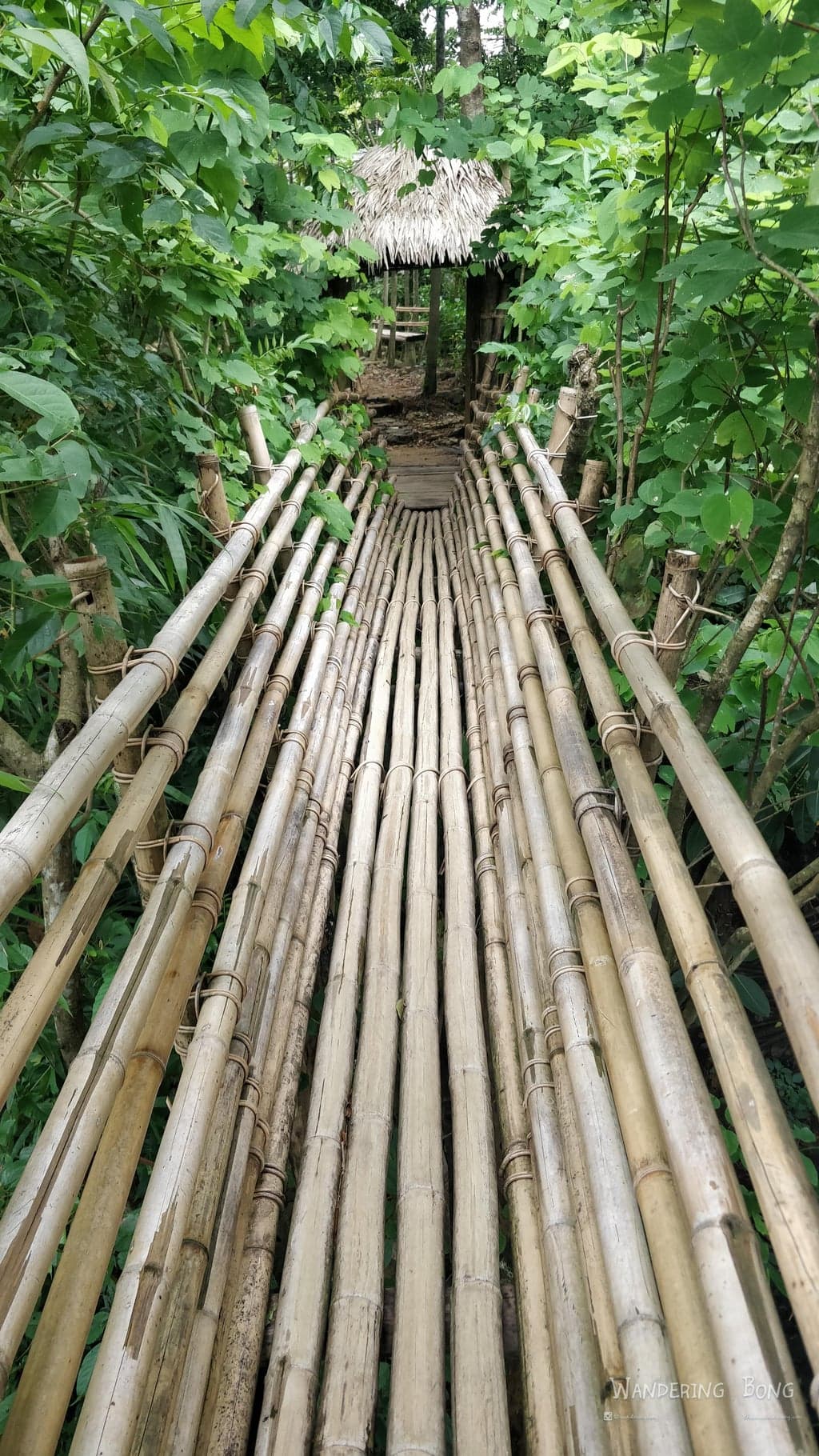
A signboard near the stairs on the other side caught our eye, a viewpoint, 15 minute hike according to the signboard. We decided to check it out too. Turns out it is uphill majorly, and 15 minutes turned to be almost half an hour. It was a nice little hike, we got to experience a bit off the Meghalayan countryside. The pathway lead us into a small village and view point inside it called the Nowhet viewpoint. A local made viewpoint at the edge of a hill made from materials like bamboo, rubber wood, etc. I was a bit hesitant on venturing to what seemed like an amatuer structure. As you head towards the platform, you are greeted to a valley of thick forests and dotted with waterfalls throughout the mountain side. A river flowing below in the gorge headed to the plains of Bangladesh.The whole view point is like a big panaroma, rather more like 360* viewpoint. (Now I regret that I forgot to take the 360). This was a total surprise view for us, we had expected a small 15 min hike to small mountain top to get a scene of some hills. But this 20-30 min hike rather took us through a very clean and maintained village and eventually to a small point of attraction view such a dramatic sight of Meghalaya. Oh and I almost forgot to add, there is also a tree house these people have built here, totally local made and on top of quite a tall tree.


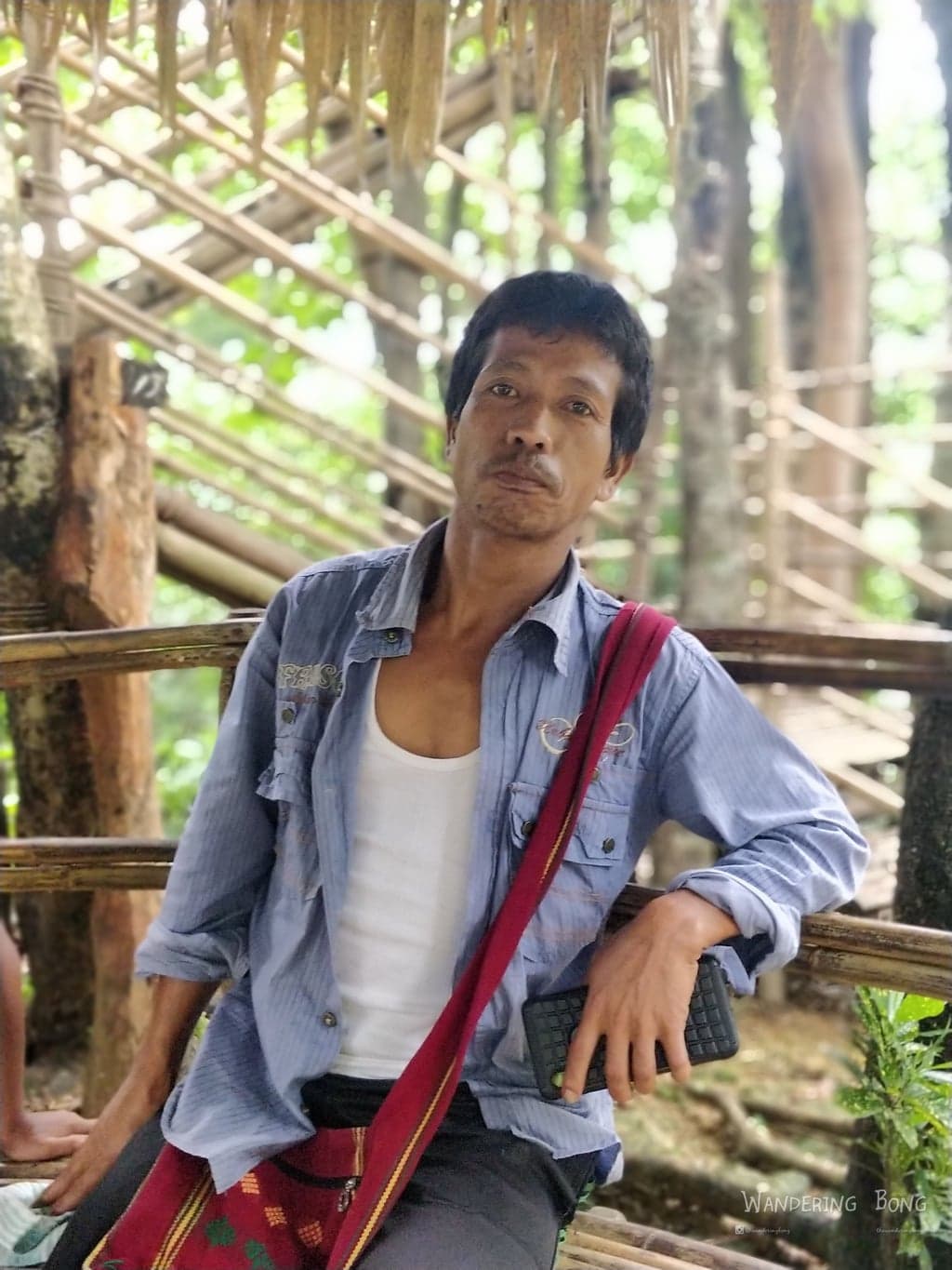
We spent a good time hanging around here, having a chat with the person who claimed he build the whole thing from scratch. We shared a few ideas to him to promote this. Do visit this place, the extra 20 mins are worth it.

The way back was faster and since we had not yet visited Mawlynnong, we hurried back. Thanks to the morning chill session we had at our natural sauna in the river, and almost a couple of hours at this viewpoint, we were a bit behind schedule. We also had to find a place to stay.
So eventually we ended up rushing in Mawlynnong and not able to get to experience it so well. Eventually, we ended up staying in Riwai itself. It was a good small homestay just 15 minutes walking away from the root bridge. This was the last night of the trip. Next, we were headed off to Shillong and then back to Kolkata via Guwahati.
Do try the Pineapples here by the way.
We headed off to Shillong, and the big red sun which had been accompanying us all along the way for the last three days was not to be seen today. From the start of the day, we got rainfall, heavy fog, and clouds all the way to Shillong. We could see barely 200m at the max on the road. It was as if we were floating in the clouds, on top of the mountains. The outside seemed like a view from the flight windows rather than one point. It was surreal. Cars seemed to be coming out of the mist, with all the indicators and lights on. We were not able to comprehend the fact that we had
Photos from Meghalaya and the start of my Sabbatical
Destination Guide
Rajasthan
Jaipur, Jodhpur, Jaisalmer, Udaipur — a destination guide to Rajasthan's desert circuits. Where to base yourself, how long to go, and what the forts actually feel like.