The Other Chikmagalur: Tea Gardens, the Kudremukh Ghat, and a Loop We Almost Missed
You've Done the Coffee Estate. Now Do Chikmagalur Properly.
The first Chikmagalur trip usually goes the same way : Drive up on a Friday evening. Wake up to mist and birdsong at the homestay. Coffee estate walk in the morning. Drive to Mullayanagiri for the views. Buy some coffee powder from town. Drive back Sunday afternoon.
That's a good trip. It's worth doing. But it's not all that Chikmagalur is.
The district is genuinely large — spread across nearly 7,500 square kilometres of the Western Ghats. The popular version of Chikmagalur occupies maybe 15% of that geography. The rest is dense forest, remote hill stations, waterfalls that require real hiking to reach, and drives so good they make you forget you had a destination.
This is the account of one such trip — a long weekend in April, just the two of us, focused entirely on the southern pocket of the district: the Kudremukh approach, the tea gardens near Samse (Goomankhan Estate), and a ghat road that nearly took us all the way to the sea. We've covered the northern circuit — Jhari, Kemmanagundi, Bhadra — separately. This one is about the south.
The Route: Bangalore → Sakleshpur → Mudigere → Samse → Kudremukh
Most people driving to Chikmagalur take the old route: Bangalore to Hassan, then west through Belur and Halebidu, arriving at Chikmagalur town from the east. It's a fine route, and Belur and Halebidu are worth stopping for. But if the southern pocket — Kalasa, Samse, Kudremukh — is the destination, there's a better way in now.
There is a four-lane highway running all the way to Sakleshpur. On our April trip from Bangalore, we didn't even register passing through Sakleshpur itself. The bypass is that complete; the town appears and disappears before you've decided whether to stop. The turn toward Mudigere and the western Ghats comes up while you're still on good tarmac, and then the road narrows naturally as you begin climbing into the estates.
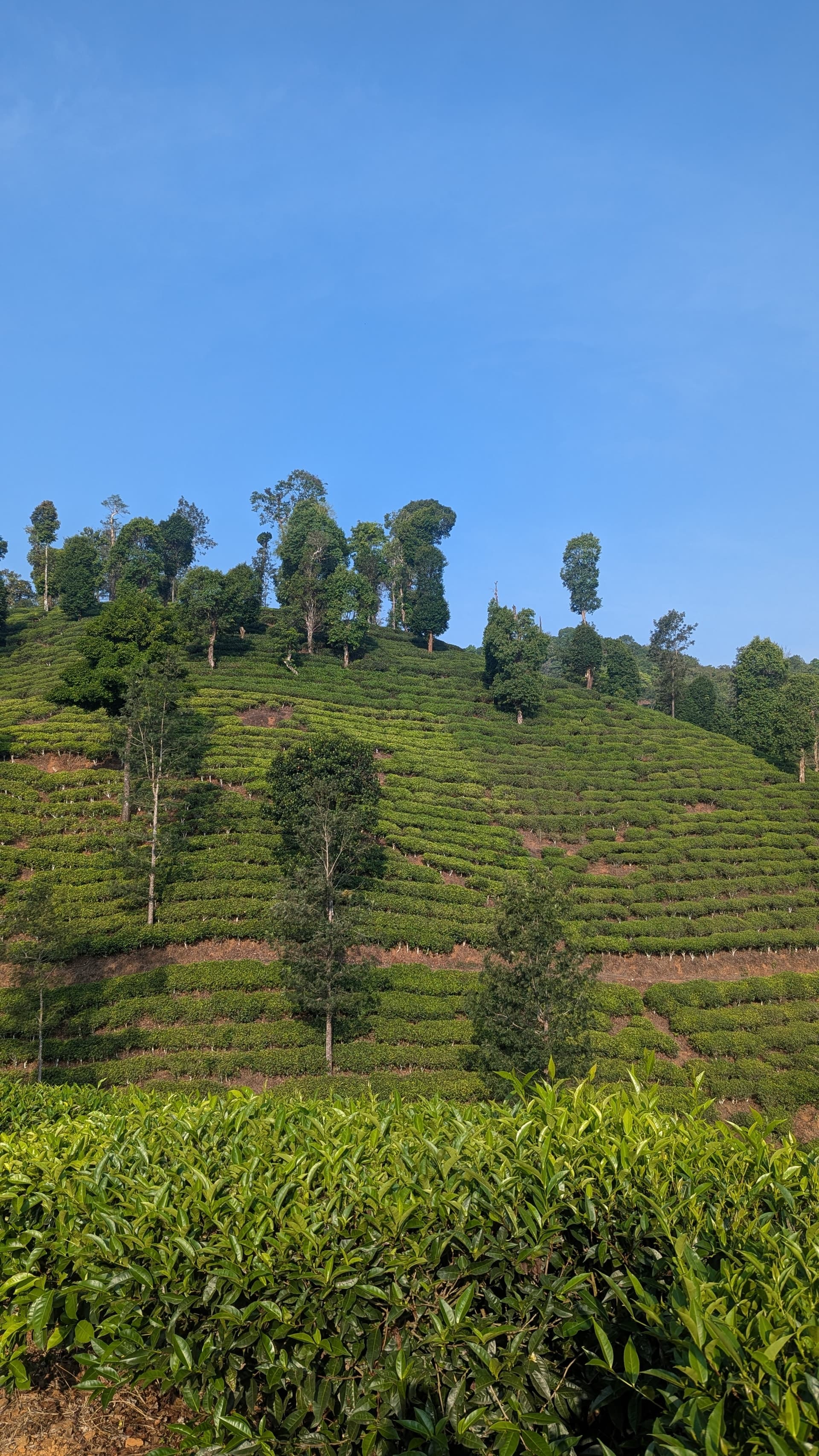
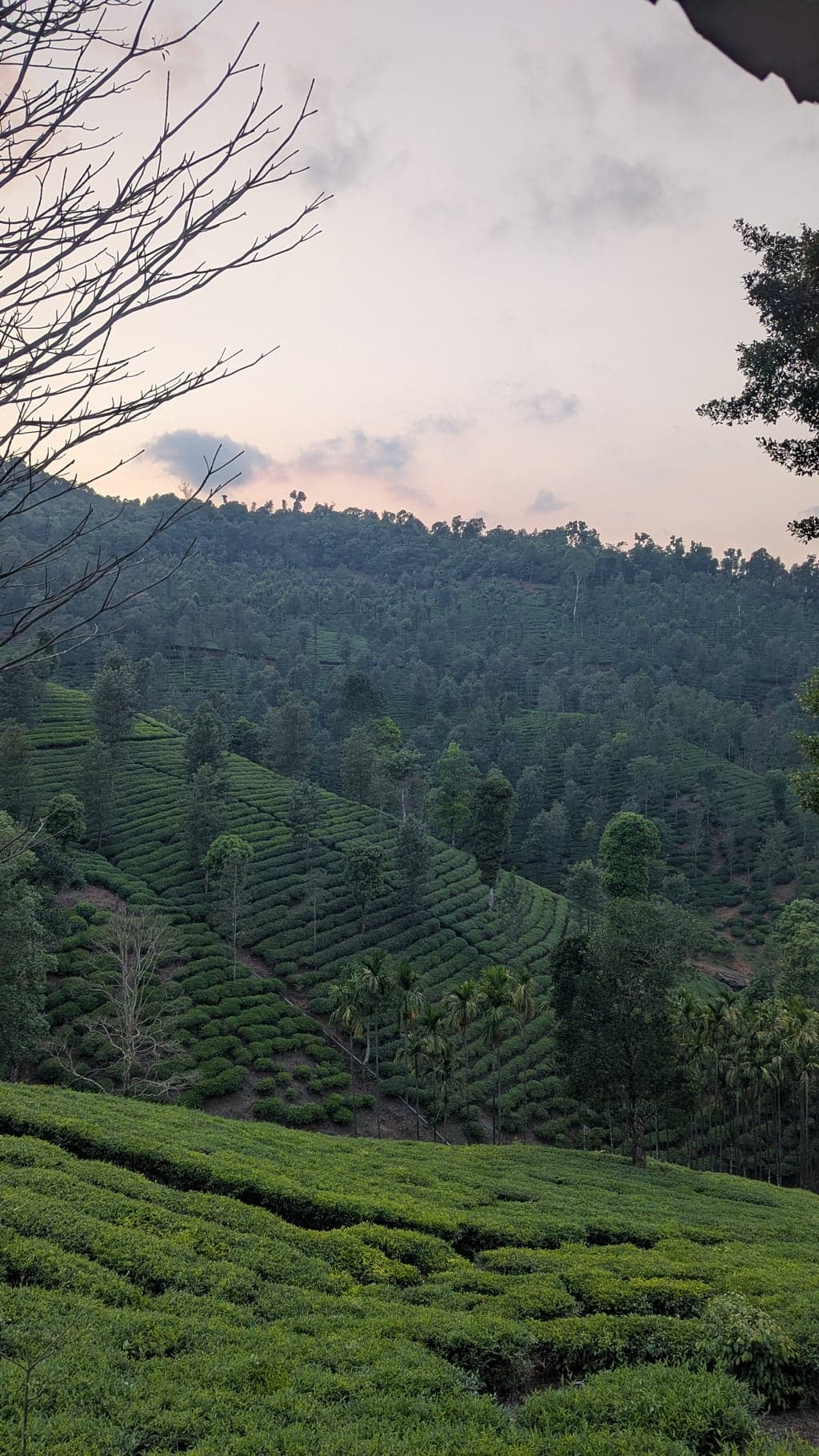
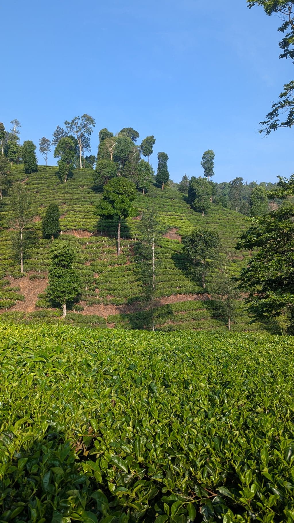
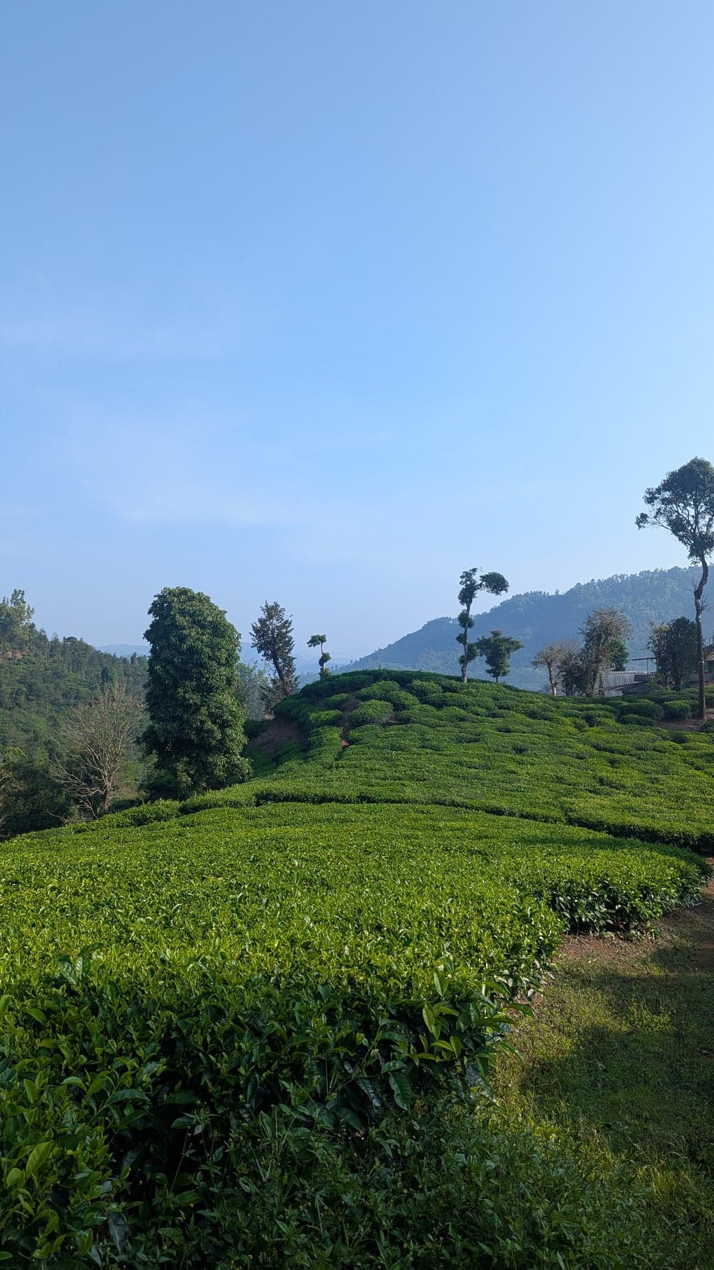
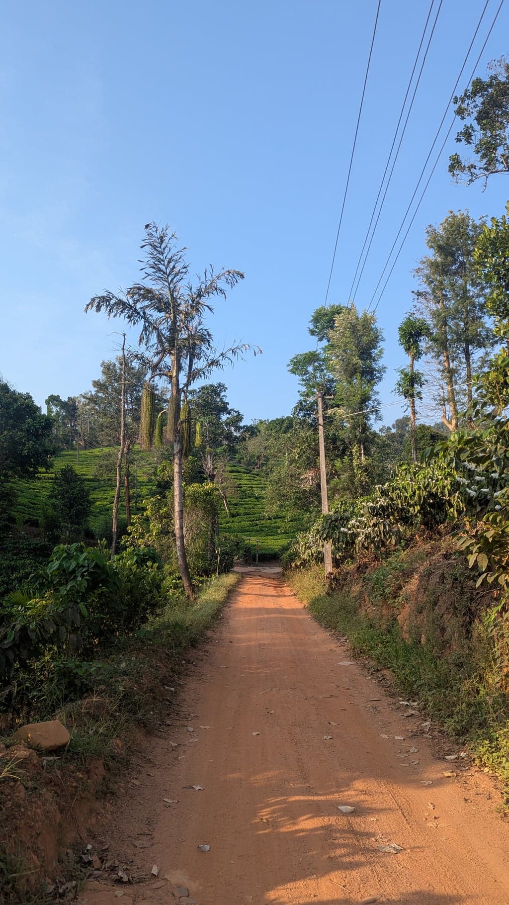
The drive from Mudigere westward is where the landscape earmarks itself. The road climbs through coffee and pepper estates in the familiar Chikmagalur way, and then somewhere between Mudigere and Samse the coffee gives way to tea. The transition is quiet but unmistakable — the bushes lower and more manicured, silver oak trees standing at intervals through the green, the whole thing sitting under a slightly different quality of light. Chikmagalur is known enough for its coffee that the tea feels like a secret. If you're driving in the early morning, the mist sits low over the bushes in a way that makes it look staged.
We left Bangalore on a Friday morning and reached Samse by afternoon.
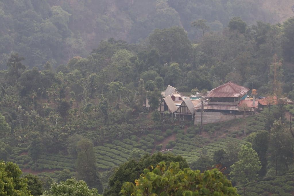
Breeze Cottages, Samse: Staying Inside the Tea Gardens
Breeze Cottages sit about 8 km from Kalasa on the road toward Kudremukh, in the middle of the Samse Tea Estate. The estate is British-era in origin — the same colonial-period plantations that established tea in this wetter, cooler microclimate when the terrain near the Kudremukh approach was found to be too wet for coffee. Tea is genuinely rare in the Chikmagalur district; most visitors never encounter it because most visitors stay in the town-side homestays, where the landscape is all coffee.
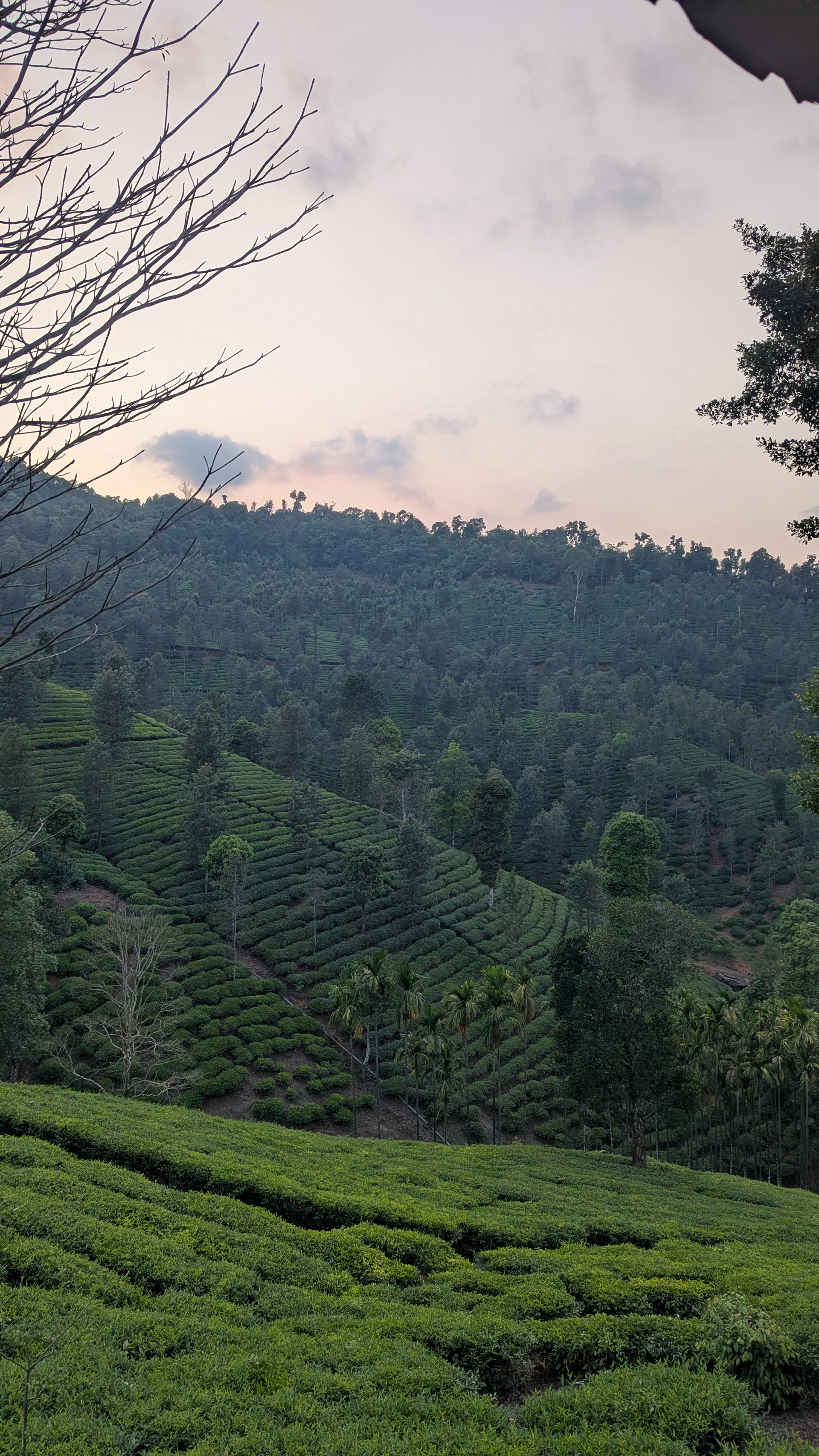
Here, the view from the rooms is unbroken tea on all sides. No network. The Kudremukh forest starts where the estate ends.

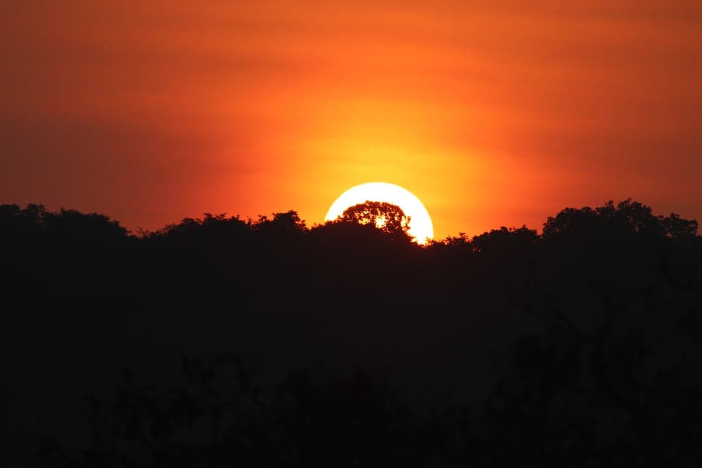
We arrived in time for the evening, which turned out to be the right call. The sunset over the tea gardens from the property — the light going orange and low across the rows, the air cooling fast, nothing to do but watch — is the kind of thing you don't plan for but end up talking about afterwards. April in Bangalore had been brutal; this was the antidote, within a day's drive.
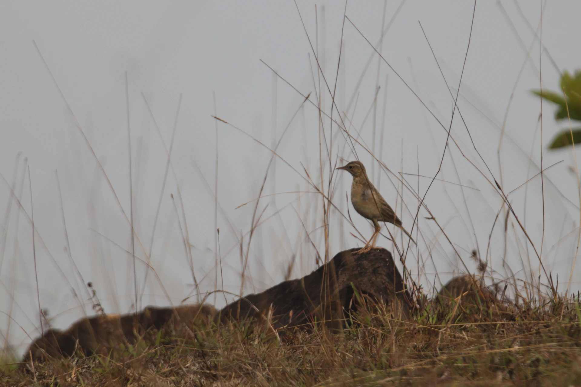
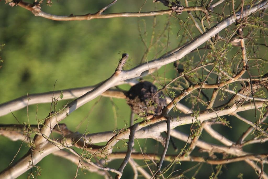
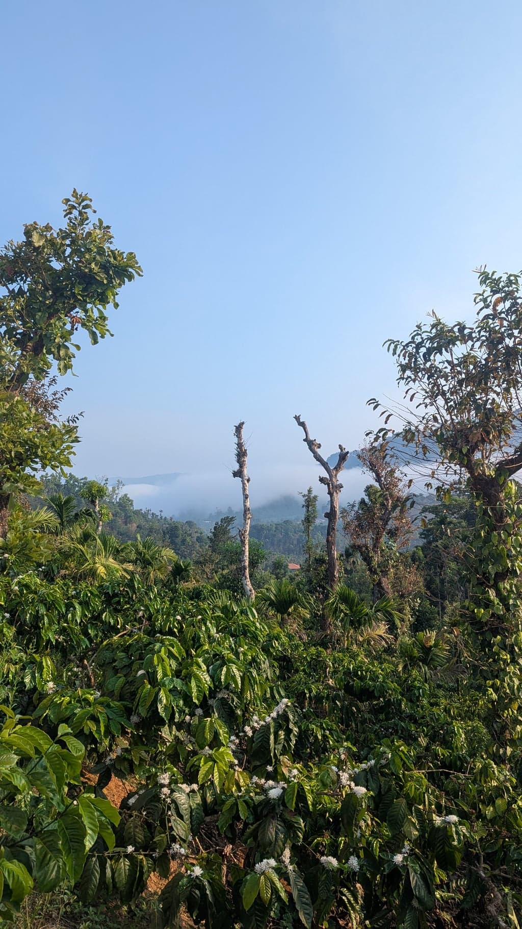
The next morning, the property has a short trail up to a viewpoint above the estate. We went early, cameras out, hoping for birds. We didn't have much luck with specific shots — the forest here is dense enough that most of the action stays hidden. But on the way back down, a peacock cleared the treeline in full display. That kind of thing — unplanned, unguaranteed, over in a few seconds — is what you come to places like this for.
Practical note: Book Breeze Cottages directly and ask about availability well in advance for weekends. The estate is also open to day visitors for tea-making tours and tastings — if you're not staying, it's still worth the detour off the Kalasa road.
Tea tip: Before leaving the Samse area, buy a packet from the Shree Ganga Tea depot at Samse. On the drive back through Mudigere, watch for the Kelagur estate on the hillside — it occupies an entire mountain face along the road and is worth slowing down for even if you don't stop.
The Tea Gardens at Samse and Kelagur: What the Drive Tells You
On the return day, driving back through Mudigere, the Kelagur Tea Estate announces itself from the road. It occupies an entire mountain face — the kind of scale that takes a moment to register when you're used to thinking of Chikmagalur as coffee country. You drive alongside it for a sustained stretch, the rows climbing the hillside above you in both directions, and there's no particular viewpoint or parking area that frames it. It's just there, on the road, if you happen to be paying attention.
We ended up spending a good part of that drive talking to Google Assistant in the car, trying to piece together a history we didn't know we were interested in. Karnataka tea is genuinely unusual — most people who've spent time in Chikmagalur over multiple trips, as we have, think of it entirely in terms of coffee. The tea estates feel like an anomaly, tucked into the wetter western fringes of the district where the elevation and rainfall create a microclimate closer to the Nilgiris than to anything further east.
The history, once you look it up: the British identified the Mudigere-to-Samse-to-Kelagur corridor as suitable for tea in the early 20th century, when the terrain proved too wet and cool for coffee to thrive the way it did further east. The Goomankhan Estate at Samse was established in 1926; Kelagur followed the same origin. There are only nine tea estates in Karnataka — almost all of them in this thin western strip of Chikmagalur district. The silver oak trees you see standing at intervals through the garden rows were planted as shade trees, a standard British plantation technique. They're still there unchanged, which gives these estates a visual quality distinct from anything in the coffee areas nearby.
It's a small thing, but it reframes the drive. Karnataka doesn't tell this story loudly. It's just there on the roadside, if you slow down enough to notice.
Day Two: The Kudremukh Drive
The second day was about the road. We drove from Samse toward Kudremukh — no fixed agenda, just the ghat and whatever it offered.
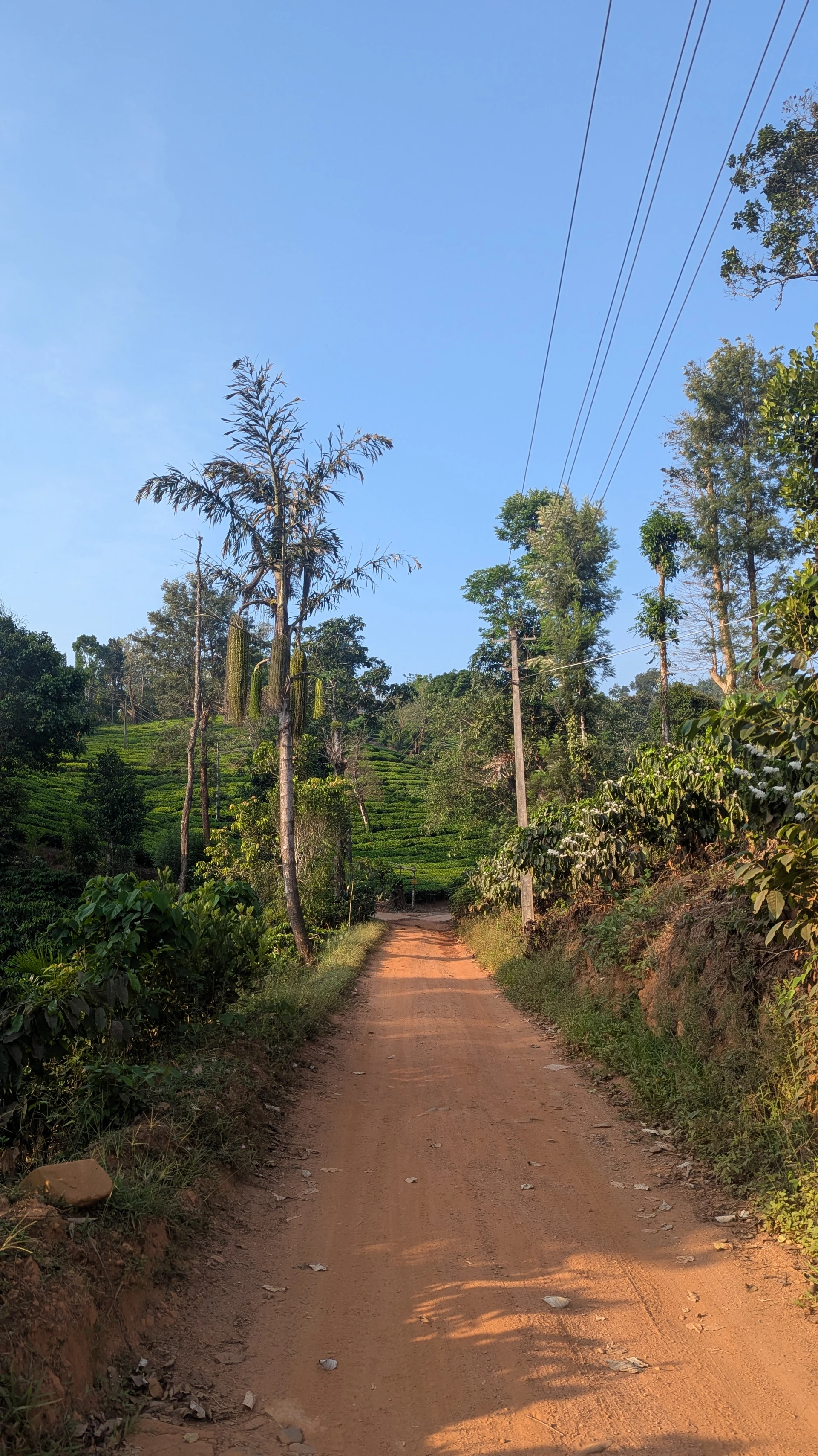
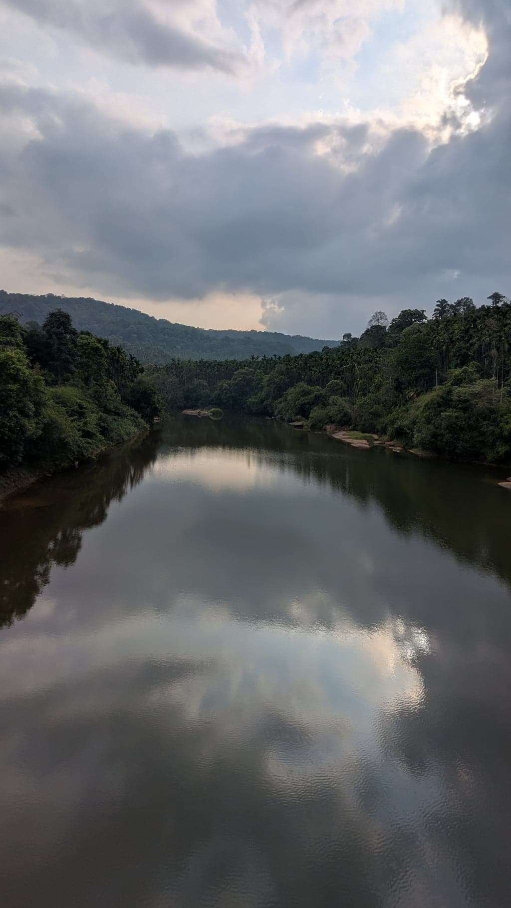
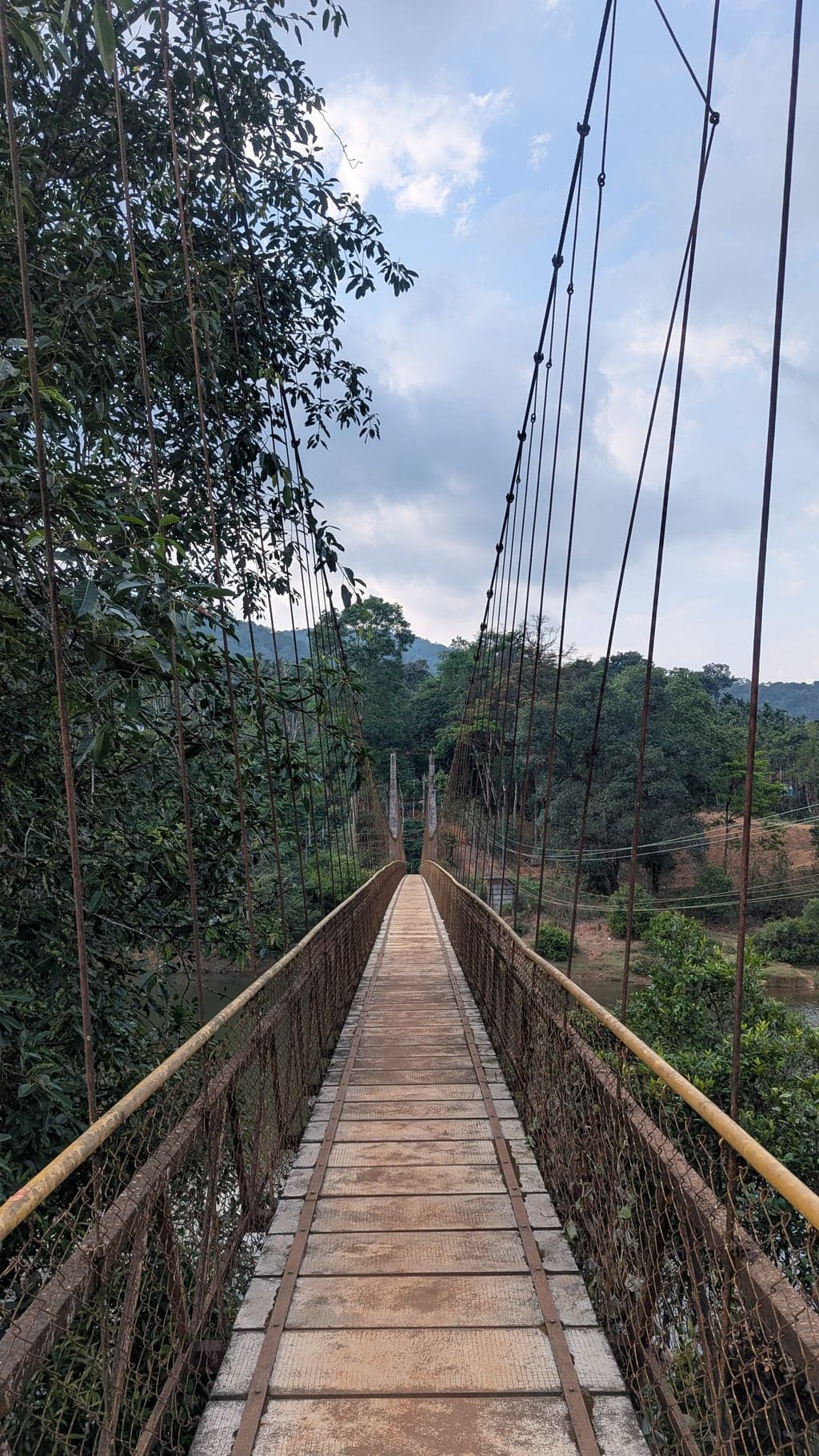
The drive through the park between Kalasa and Kudremukh is exceptional in the way that some roads are exceptional — not because of what they lead to, but because of what they are. The forest presses in from both sides, the road narrows and climbs and bends, and the light through the canopy has that quality April forests have when the pre-monsoon humidity is already building. Keep your speed down: there are a couple of hanging bridges across the river tucked into the forest along the route — easy to miss if you're moving fast, worth noticing if you catch them. They're not signposted. They're just there, swaying over the water.
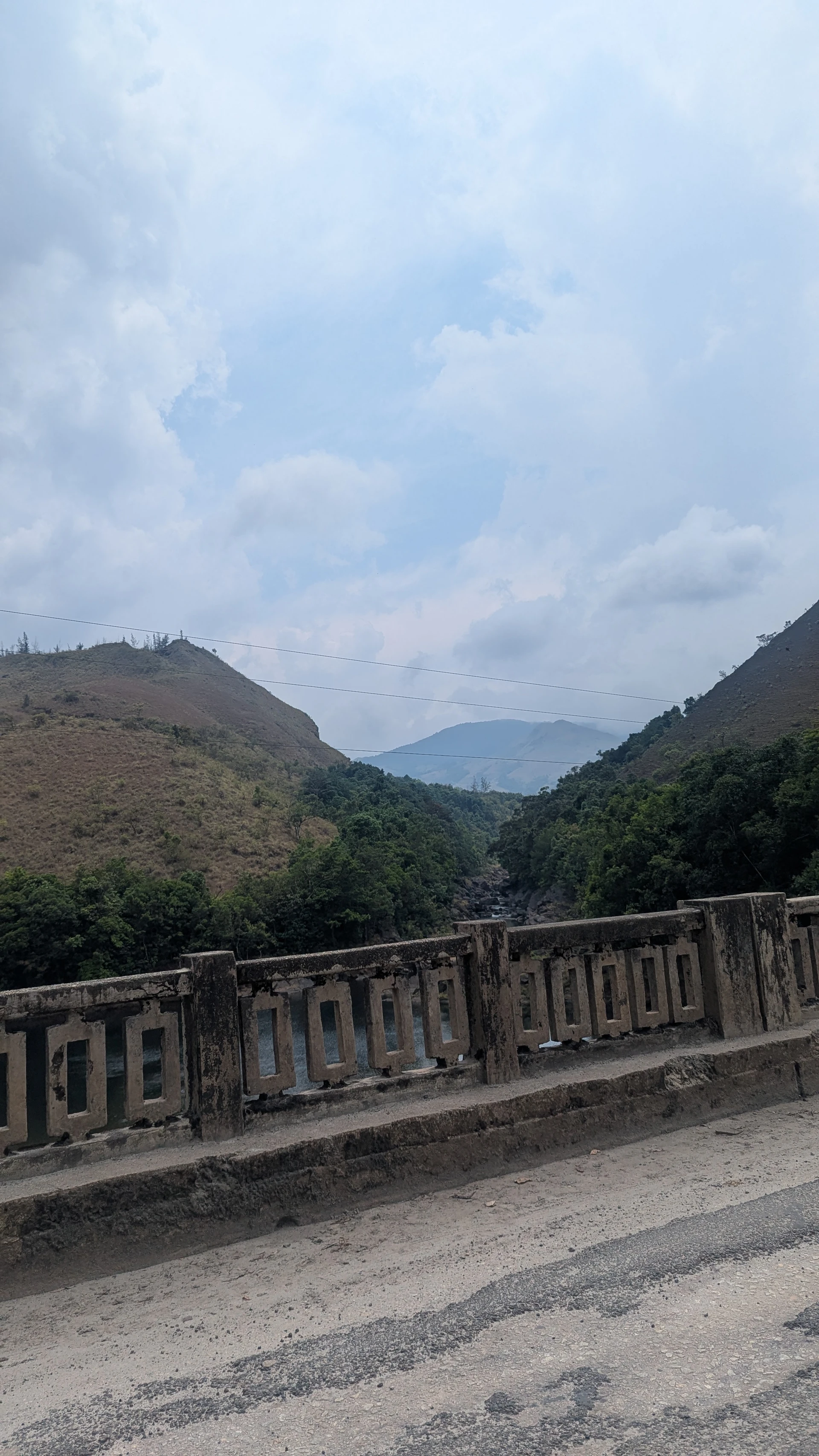
One thing to plan for before you enter: there is nothing along this route. No food, no stalls, nothing until you exit at Karkala on the other side. Eat before you go in, fill the tank, carry water. The park is not set up for stops — which brings us to the rules.
The Checkpoint, the Time Limit, and the One-Way Rule
At the entry checkpoint you declare your route — toward the Kudremukh side or toward Sringeri — and get a time limit accordingly. It's one-way: you cannot exit from the same side you entered. If you come in from the Kalasa side heading toward Kudremukh, you exit toward Karkala. You do not come back through the same checkpoint. The logic is simple: a time limit on a one-way route is the only way to verify nobody stopped inside. You also cannot stop while driving — keep moving, windows down, slow enough to take it in. It's an oddly focused way to see a forest, and it works.
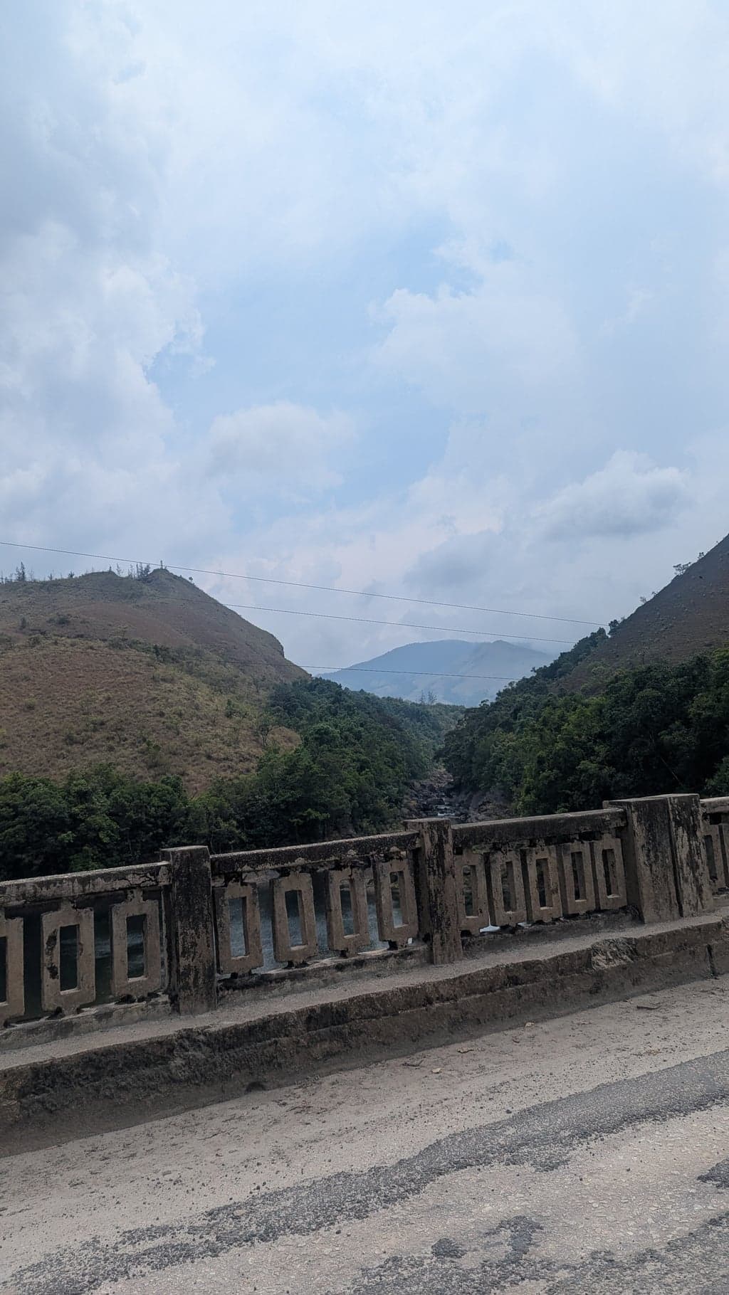
We drove through toward the Karkala exit. Past the point where the forest gets so dense it blocks the sky, watching the elevation drop and the vegetation shift from shola to something wetter and more coastal — and then we were out, on the other side, near Karkala, with the ghat behind us. We turned back from there, about an hour from the coast.
The road gave us the whole thing again in reverse. Which wasn't a hardship.
If you have a day with no fixed agenda and a full tank — and a full stomach before the checkpoint — follow this ghat to Karkala and see what the other side of the Western Ghats looks like. It's one of those drives that justifies the trip independently of everything else.
Sringeri: The Miss We're Still Thinking About
We didn't make it to Sringeri on this trip. In hindsight, that was the wrong call — and I'm including this section specifically because the better route only became obvious after the fact, which is the kind of thing worth writing down.
On Day 2, we drove down the Kudremukh ghat toward the coast and turned back about an hour from Udupi. It was a good drive. But there was another option sitting right there on the map that we didn't take: instead of going deeper into the ghat toward the coast, we could have turned toward Sringeri — which is 35 km from Kalasa on a different road — spent a few hours there, and then looped back through the Sringeri ghat. That route would have given us the temple, the Tunga river, the Charmadi Ghat section, and an entirely different view of the same forest on the return. A proper loop through two ghats in a single day, anchored by one of the most significant temples in Karnataka. Nobody told us this was an option. We figured it out too late.
So: if you're planning this trip and you have Day 2 free, the Sringeri loop is the move. Drive from Samse/Kalasa toward Sringeri in the morning, spend two or three hours at the Sharada Peetham, then take the Charmadi Ghat back toward the coast road and loop back to your base. It's a longer day than our Kudremukh drive, but it covers more ground and has an actual destination at its centre.
On the temple itself: the Sharada Peetham is one of the four mathas established by Adi Shankaracharya in the 8th century — the monastic institutions that have anchored Hindu philosophical tradition for over twelve centuries. The Sharadamba Temple sits directly on the bank of the Tunga river: fast, clear, cold, running green over smooth rocks, with the forest pressing in from both banks. The fish in the river are considered sacred and completely unafraid of humans — they'll swim up to your hand if you crouch at the water's edge. It sounds like a minor detail. It isn't.
We'll go back for this. Next time, Sringeri is the anchor, not the afterthought.
The Rest of Chikmagalur: What This Article Isn't About
The southern pocket is one part of a much larger district. Chikmagalur has several distinct zones, each worth its own trip — and we've written about most of them elsewhere:
- Jhari and the central pocket — the waterfall inside the coffee estate, estate jeep safaris at dawn. The kind of immersive morning that the northern circuit is built around.
- Kemmanagundi — the hill station at 1,434 metres inside the Bhadra Wildlife Reserve, established by the Mysore Maharaja, with the two-tier Hebbe Falls as its centrepiece. Worth its own overnight.
- Bhadra Wildlife Sanctuary — the tiger reserve and reservoir that wraps around Kemmanagundi. The boat ride through submerged forest is Bhadra's underplayed highlight.
- Sakleshpur corridor — the old Hassan–Mangalore railway ghat, Manjarabad Fort, the Donigal–Yedakumeri stretch. The new four-lane highway means most people now bypass Sakleshpur entirely without realising what they're missing. Worth a dedicated detour on either end of this trip.
The full circuit — both northern and southern loops — takes five nights minimum. Don't try to compress it into one long weekend.
If this is your first Chikmagalur trip and you want the full picture — all the pockets, the season calendar, where to stay across the district — we've mapped that out in the main Chikmagalur travel guide.
Suggested Itinerary: The Southern Loop (2–3 nights)
Best season: October to January for the Kudremukh trek. July–September for the monsoon forest. April–May works well as a summer escape — the forest keeps it 8–10 degrees cooler than Bangalore.
Day 1 (Friday): Leave Bangalore early morning. Four-lane highway to Sakleshpur, turn west toward Mudigere, continue down to Samse — arrive by afternoon. Check in at Breeze Cottages. Evening free: the sunset over the tea rows is the activity. No network, which is the point.
Day 2 (Saturday): Early morning walk up the viewpoint trail at the property. Mid-morning: two options from here. Option A (what we did) — eat before you go, carry water, then drive toward Kudremukh. Slow down for the hanging bridges along the route. At the checkpoint declare your route and follow the ghat one-way through to the Karkala exit — you come out the other side of the Western Ghats near the coast. Turn back from Karkala and return to base via the same road outside the park. Option B (what we'd do next time) — drive to Sringeri instead (35 km from Kalasa), spend 2–3 hours at the Sharada Peetham and the Tunga riverbank, then return via the Charmadi Ghat for a proper two-ghat loop. Option B is the better call; we only realised this after the fact. Overnight Samse, Kalasa, or Kudremukh village.
Day 3 (Sunday, optional): Morning at Sringeri — temple, Tunga riverbank, one unhurried hour. Drive back via Mudigere; the Kelagur estate is visible from the road as you pass through — an entire mountain face of tea, worth slowing down for. Pick up coffee from an estate cooperative and tea from the Shree Ganga depot at Samse before leaving. Back in Bangalore by evening.
Practical Notes
- Route in: Bangalore → Sakleshpur (new 4-lane highway) → Mudigere → Samse/Kalasa. Faster and more scenic than the old Hassan–Belur route for the southern pocket.
- Manjarabad Fort (Sakleshpur): If you want to stop, set navigation specifically to the fort — the new bypass means the turnoff doesn't announce itself from the highway.
- Vehicle: A regular car handles Samse and Kalasa fine. Forest roads inside the national park proper need a high-clearance vehicle.
- Kudremukh National Park entry: Checkpoint at the park entry — declare your route (Kudremukh/Karkala side or Sringeri side) and you get a time limit. It's one-way: you exit toward Karkala on the coast side, not back the way you came in. No stopping inside the park while driving. Critically: there is no food, no stalls, nothing along the entire route until Karkala — eat before you enter and carry water. The peak trek requires a separate advance permit through the Karnataka Forest Department portal.
- Mobile connectivity: Patchy from Samse onward. Non-existent inside the park core zone. Download offline maps before entering.
- Summer travel: The Kalasa–Samse–Kudremukh pocket is one of the few destinations in Karnataka's interior that genuinely works in April and May. The altitude and forest cover run 8–10 degrees below Bangalore.
- Monsoon travel (Jul–Sep): The forest is extraordinary but comes with leeches. Tuck trousers into socks, carry salt.
FAQs
Is this trip viable in April or May?
Yes — it's specifically good in summer. The southern pocket stays significantly cooler than Bangalore. We went in April and it worked well as a heat escape.
What's the best use of Day 2 — the Kudremukh ghat drive or Sringeri?
Sringeri, if we're being honest about it now. Drive to Sringeri in the morning (35 km from Kalasa), spend time at the Sharada Peetham and the Tunga river, then return via the Charmadi Ghat for a two-ghat loop. It's a more complete day than the Kudremukh coast drive, and it has an actual destination rather than a turnaround point. We did the coast drive and don't regret it — but the Sringeri loop is what we'd do on the next trip.
How does this connect to the rest of Chikmagalur?
The southern pocket is a self-contained 2–3 night trip. The northern circuit (Jhari, Kemmanagundi, Bhadra) is a separate 3-night trip. Trying to combine both in one long weekend means spending most of Day 3 in the car. Split them across two trips.
Should I combine this with Belur and Halebidu on the way back?
Yes, if you exit via Hassan rather than Sakleshpur. The Hoysala temples take 2–3 hours and sit directly on the route. We've written that trip up here.
Photos from The Other Chikmagalur: Tea Gardens, the Kudremukh Ghat, and a Loop We Almost Missed

Canon Canon EOS 77D — 600mm • ƒ/6.3 • 1/125 • ISO 1600
Google Pixel 7 — 7mm • ƒ/1.9 • 1/281 • ISO 47
Google Pixel 7 — 7mm • ƒ/1.9 • 1/25 • ISO 875
Canon Canon EOS 77D — 150mm • ƒ/6.3 • 1/250 • ISO 160
Canon Canon EOS 77D — 375mm • ƒ/6.3 • 1/800 • ISO 100
Canon Canon EOS 77D — 600mm • ƒ/6.3 • 1/50 • ISO 1600
Canon Canon EOS 77D — 600mm • ƒ/6.3 • 1/640 • ISO 1600
Canon Canon EOS 77D — 600mm • ƒ/6.3 • 1/800 • ISO 500
Canon Canon EOS 77D — 600mm • ƒ/6.3 • 1/1000 • ISO 640
Google Pixel 7 — 7mm • ƒ/1.9 • 1/1167 • ISO 47
Google Pixel 7 — 7mm • ƒ/1.9 • 1/1300 • ISO 49
Google Pixel 7 — 7mm • ƒ/1.9 • 1/851 • ISO 50
Google Pixel 7 — 7mm • ƒ/1.9 • 1/1002 • ISO 53
Google Pixel 7 — 7mm • ƒ/1.9 • 1/58 • ISO 221
Google Pixel 7 — 7mm • ƒ/1.9 • 1/205 • ISO 112
Google Pixel 7 — 2mm • ƒ/2.2 • 1/4651 • ISO 39
Google Pixel 7 — 7mm • ƒ/1.9 • 1/1143 • ISO 46
Google Pixel 7 — 7mm • ƒ/1.9 • 1/2833 • ISO 49
Related Galleries
Destination Guide
Bangalore Escapes
Chikmagalur, Coorg, Mysore, Hampi, Gokarna — weekend escapes from Bangalore. Where to go, when to leave, and how long to stay.